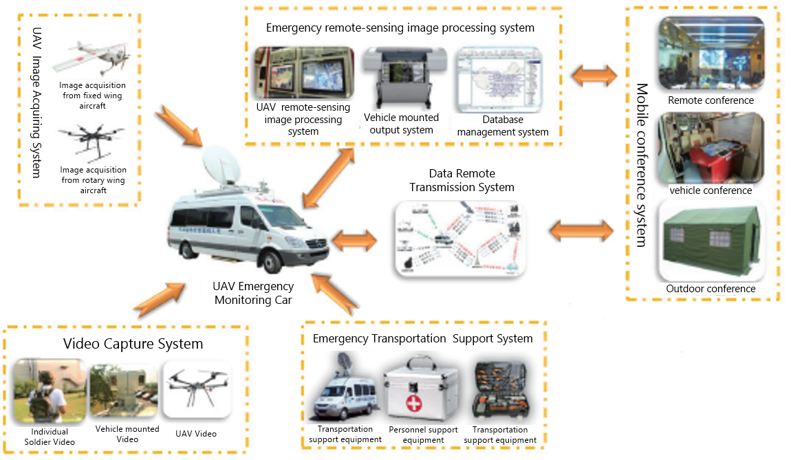
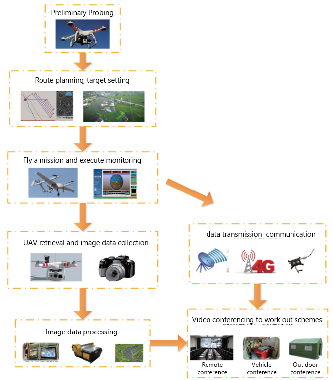
Second step: Make flight mission plan, determine the key shooting object, determine the scope of flight, determine the planning route, determine the flight altitude, determine the flight speed.
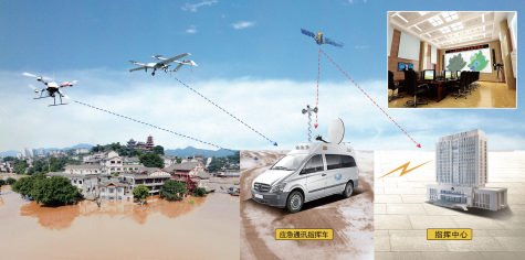
Third step: Execute flight mission,fixed wing UAV carry out large area remote sensing image acquisition, in the flight process, real-time monitoring of the aircraft, encounter unexpected situations, timely adjustment of flight plans to ensure the safety and reliability of the UAV to complete the mission.
Fourth step: Recovery of the UAV, extraction of images, image processing taken by using remote sensing image processing system, image processing: 1, high precision synthetic disaster remote sensing image; 2, establishment of three-dimensional of sand model of disaster area; 3, use the generated point cloud image, to calculate the range and make analysis of each part and finally store the data in the database for backup.
Fifth step: Using the remote data transmission and communication system, the data can be transmitted to the rear command post, which can display the three-dimensional holographic image, and can display the disaster change dynamically, and the extent of the flood. Let decision makers to have an overview of the disaster area,to enable more efficient, professional and accurate command and decision-making, .


